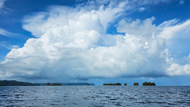
Palau (Pop 18,055) is simply perfect and a paradise. Even in cloudy weather it looks a treat !!! It is 0.67% the size of Tazzie but it is famous for its archipelago of jungle covered basalt islets that look like moss covered jigsaw covered pieces scattered randomly on the ocean from the skies above.
Welcome to Palau, my 113th Visit and 108th Run UN Country in the world out of 193.
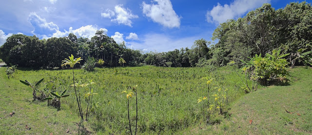
Palau is an archipelago of over 300 islands, part of the Micronesia region in the western Pacific Ocean. Koror Island is the islands’ commercial centre. The larger Babeldaob has the present capital, Ngerulmud, plus mountains and sandy beaches on its east coast. In its north, ancient basalt monoliths known as Badrulchau lie in grassy fields surrounded by palm trees. Babeldaob is covered in dense luscious rainforest surrounded by crystal clear turquoise water – such a rare combination to see.
The country was originally settled approximately 3,000 years ago by migrants from Maritime Southeast Asia. Palau was first drawn on a European map by the German missionary Paul Klein. Palau islands were made part of the Spanish East Indies in 1885. Following Spain's defeat in the Spanish–American War in 1898, the islands were sold to Germany in 1899. After World War I, the islands were made a part of the Japanese-ruled South Seas Mandate by the League of Nations. During World War II, skirmishes, including the major Battle of Peleliu, were fought between American and Japanese troops as part of the Mariana and Palau Islands campaign. Along with other Pacific Islands, Palau was made a part of the United States-governed Trust Territory of the Pacific Islands in 1947. Having voted in a referendum against joining the Federated States of Micronesia in 1978, the islands gained full sovereignty in 1994 under a Compact of Free Association with the United States.
Politically, Palau is a presidential republic in free association with the United States, which provides defense, funding, and access to social services. Legislative power is concentrated in the bicameral Palau National Congress. Palau's economy is based mainly on tourism, subsistence agriculture and fishing, with a significant portion of gross national product (GNP) derived from foreign aid. The country uses the United States dollar as its official currency. The islands' culture mixes Micronesian, Melanesian, Asian, and Western elements. Ethnic Palauans, the majority of the population, are of mixed Micronesian, Melanesian, and Austronesian descent. A smaller proportion of the population is of Japanese descent. The country's two official languages are Palauan (a member of the Austronesian language family) and English, with Japanese, Sonsorolese, and Tobian recognized as regional languages. 73% of the population is indigenous Palauan and they have their own language and culture, which no other Micronesian or Indonesian peoples understand. Palauans are amongst the world’s oldest peoples rivalling my own first nation aboriginal people from Australia – anthropologists believe that Palau was first occupied some 50-60,000 years ago.
Palau is mostly visited by the Japanese given the connections with WWII.
It is a divers paradise with lots of coral surrounding the islands. Many of the diving and island touring companies are actually owned and run by Japanese people who have made Palau their home.
I hired a car and drove extensively to most parts of the main islands of Koror and Babeldaob.
On Koror I visited the following places of interest: Belau National Museum, Long Island Park, Palau Aquarium, Nan'yō Shinto Shrine. I also sent Mini and Ava across the “basalt jungle jigsaw island pieces” of Nikko Bay, which epitomises most photographs, and footage of Palau as a destination. I swam my 2km in Nikko Bay, which involved the calmest coral laden water I have ever swum in – simply terrific.
I drove the much larger island of Babeldaob over two days. On the first day, I visited the southern half: World War II Japanese Communications Centre, Bai Ra Rengarairrai (traditional Men’s Meeting House), Korean World War II War Memorial, Palau National Capital (Ngerulmud, Capital City), Melekeok, Malsol’s Tomb, Ngerkeai. Malsol’s Tomb was the hardest place to get to and the WEIRDEST !!! Malsol was a warrior who succumbed to a Romeo and Juliet story in reverse !!! He offended Juliet who ended up stoning him to death and burying him with the stones she threw at him !!! How weird and sad is that !!! Melekeok was my favourite given its terrific shoreline where EVERY house is opposite the crystal clear ocean – not bad for a village.
I found Palauan people and culture to be very similar to that of the Solomon Islands – simple way of life stepped in family values and the sea. The Paramount Chiefs are important and preserve the culture by handing it down through stories, food, costume and dance. Most of the island is now Christian.
Only downsides to Palau is that everything is expensive - two reasons: the currency is USD and too strong for the locals and EVERYTHING has to be brought in by ship from thousands of miles away. Another drawback is the lack of accessible, natural beaches - ironic given the crystal clear torquoise waters of the islands - any beaches have really bad roads to them that need serious 4WD to reach.
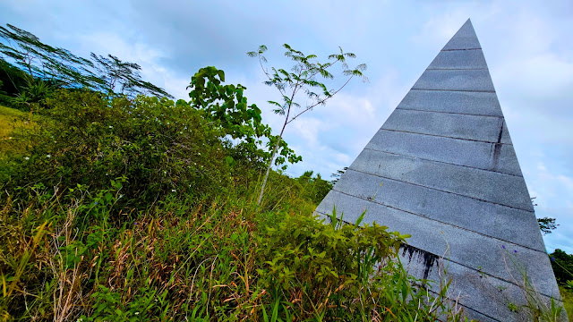
On the second day I drove the northern half of Babeldaob island and visited the following places: WWII Abandoned Transport Graveyard, Japanese Monument, Stone Path Traditional Village, Mount Ngerchelchuus, Ngardmau Waterfall, Ollei Marina, Japanese WWII Lighthouse, Baderulchau Stone Monoliths, Airai, Long Island (2km Swim).
My favourite were the Stone Monoliths since they reminded me of Stone
Henge meets Easter Island. Possibly the largest and oldest archaeological site
in Palau, the Badrulchau Stone Monoliths consists of 52 basalt megaliths lined
up in two rows, crude faces carved into some of them. Archaeologists estimate
its construction dates back to around the year 161. The purposes of these stone
monuments have been a question, but it is believed that they served as pillars
for a bai, a type of traditional Palauan meeting-house. According
to legends, this bai was constructed by the gods and could house
thousands of people at one time. If that is the case, the monoliths may be the
remains of the largest bai ever built. Bai’s are very
important in Palau and indeed most of the Nesian collective peoples of the
Pacific since they are the prototypes of Pacific Parliament way before the West
even thought of it. The views from the monoliths here gaze across the very
northern tip of Babeldaob which is like a tri-colour painting of there layers
of ocean - see pics below. The Ngardmau
Waterfall is also worth walking the 1km it takes to get there literally in the middle of the jungle and I was lucky to be the only one there !!! The falling water takes the shape of a shark jaw and creates a rainbow between the two "jaws" - very unusual to see of a waterfall.
Having driven 339km across the length and breadth of Palau I realised just how good the main roads are – heaps better than any other Pacific Island roads I have encountered and light years ahead of the Philippines !!!
My last day in Palau was simply the best and the crowning moment. I spent a whole day cruising the so-called “Rocky Islands” of the south, which are the quintessential definition of Palau. Every last bot of rocky or island, be it volcanic basalt or sedimentary limestone is covered in lush green vegetation. The waters hers are crystal clear and green with a quilt-like checkering of coral just beneath the surface. The islands I visited are THE ONES to see as follows: The Milky Way (Lagoon), Long Lake & Secret Lagoon (Kayaking), Ngeramous Island or Shark Island (Lunch), Jellyfish Lake (Snorkelling Jellyfish), Paradise Island Lagoon (Coral Snorkelling).
The Milky Way and Jellyfish Lake are by far and away the most popular and an absolute MUST SEE if you wish to leave Palau with Pride !!! The Milky Way gets its name from the fine white clay that lies on its bottom that when applied to you skin and allowed to dry rejuvenates it even though you look like a first peoples aboriginal from Australia !!! The Jelly fish Lake must be 38 to 42 C and reminds me of the blue thermal mineral hot baths of volcanic Iceland except this place look nothing like it !!! The Jellyfish Lake is usually swamped with the little critters – literally everywhere but due to recent heavy monsoons and a change in temperature of the lake you will only see a few dozen as you swim around and not too close together. Nevertheless they are very graceful creatures with the typical clear variety and ones that look like golden octopi !!!
Kayaking in Long Lake brought out the best in scenery since you can get very close and personal with the jungle covered limestone islets, especially lying on your kayak under the shade of trees in Secret Lake where the sound of a myriad birds comes to life.
The coral around Paradise Island may lack colour but the shapes are crazy, mostly dominated by huge cabbage coral with its broad layered "leaves". This place also has a myriad of coloured tropical fish which are not shy of swimming around you and some even take a nibble or two of dead skin on your back and feet !!!
We had lunch on an isolated island, which reminded me heavily of the island that John F Kennedy was stranded on back in the Solomons. Palauan food was originally like most of the pacific – fish and breadfruit but one of the benefits of being occupied by the Japanese in WWII brought heavy influences of Japanese diet and now it is commonplace on the island as you can see from my photo – a BENTO BOX !!!
Taking a tour of the Rocky Islands (see second last picture) is a real treat and involves a lot of different activities.
This last day and the great weather it featured was the best of my trip so far – such beauty – such preservation. Indeed Palau is pristine and perfect and the best is that it is not visited by many – perfect for those looking for a true island paradise as the images below clearly prove… (The last two are a special treat from myself and my new drone "Mini") !!!


No comments:
Post a Comment