Welcome to Saipan, a “commonwealth” of the United States and not a UN Country. This is my 5th overseas territory for both Visit and Run.
Saipan (Pop 49,551) is only 1.7% the size of Tasmania and is officially part of the CNMI or “Commonwealth of the Northern Marianas Islands” which comprises a 523km long archipelago of 14 islands, the principal inhabited islands being Saipan, Guguan, Rota. Saipan is not a territory of the US like Guam but a commonwealth. What the heck is a US commonwealth ? Glad you aksed ! Let m explain it by saying that a US territory is what comes before a US state but in the case of CNMI, they were offered independence (like Palau) but did not choose it so the USA gave them special status above a territory but not quite a US state. CNMI has its own multi-party elections and runs itself with a US appointed Governor overseeing what they do. A little like Australia, the Head of State of CNMI is the US President but he has no right of veto over CNMI laws but can sack the government like our own English Monarch.
As a result of being a commonwealth, the island has no US military presence and is instead a giant memorial to the fierce and bloody battles fought between the USA and Japan when the US landed here in June 1944. More on this soon.
Traces of human settlements on Saipan have been found by archaeologists over 4,000 years ago, including petroglyphs, ancient Latte Stones – no not coffee but pillars that look like mushroom stools that hold up the meeting places of the village chief and his key ministers.
The indigenous of Saipan are the Chamorros – the same as Guam with their own language and distinct from Micronesians and Palauans.
The Spanish formally occupied the island in 1668. After 1670, it became a port of call for Spanish and occasional English, Dutch and French ships as a supply station for food and water.
After the Spanish–American War of 1898, Saipan was occupied by the United States. However, it was then sold by Spain to the German Empire in 1899.
In 1914, during World War I, the island was captured by the Empire of Japan. Immigration began in the 1920s by ethnic Japanese, Taiwanese and Okinawans, who developed large-scale sugar plantations. Japan considered Saipan to be part of the last line of defences for the Japanese homeland, and thus had strongly committed to defending it. The Imperial Japanese Army and Imperial Japanese Navy garrisoned Saipan heavily from the late 1930s, building numerous coastal artillery batteries, shore defences, underground fortifications and an airstrip. In mid-1944, nearly 30,000 troops were based on the island.
The Battle of Saipan, from 15 June to 9 July 1944, was one of the major campaigns of World War II. The United States Marine Corps and United States Army landed on the beaches of the southwestern side of the island and after 28 days of heavy fighting, captured the island from the Japanese. The battle killed 3,426 American soldiers, 23,242 Japanese soldiers and uncounted thousands of Japanese, Korean and indigenous civilians.
There are many memorials and wrecks to attest to the mayhem that
occurred here in WWII. I saw many of these, which you will too in the photos
below.
Saipan is nothing like Guam – heaps smaller, nicer, quieter and friendlier. Like Guam it is surrounded by a coral shelf with pristine crystal waters.
Garapan (Pop 14,122) is the main city and undergoing a lot of reconstruction and upgrading. It has a brand-new up-market mall and a massive gold-encrusted Casino that was opened in 2014 by a very wealthy Chinese widow and her son but now lies dormant given COVID19 !!!
In the four days and three nights I was here I hired a car and drove a total of 197km around the entire island absorbing its history and locals like one giant outdoor museum. The strangest custom I encountered was cars putting on their hazards and stopping to let me take photos and film of downtown scenery – it seems that pedestrians have the right of way here.
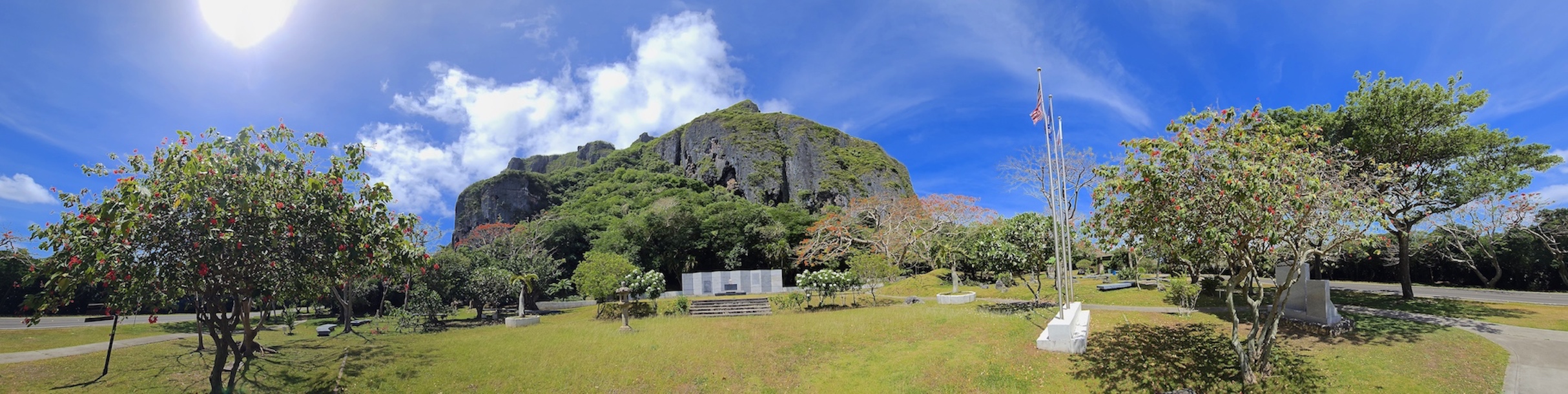
I visited the following places. In the northern half of the island: Tanapag Beach, Pau Pau Beach, Wing Beach, Korean Peace Memorial, Last Japanese Command Post (Has Wrecks), Japanese Peace Memorial, Banzai Cliff (Northmost), Suicide Cliff, The Grotto, Bird Island Lookout, Abandoned Pacific Barrier Radar III, Semi-Submerged US Tank (off Saipan World Resort). In the southern half of the island: Saipan World Resort Beach (2.1km Swim), Mount Carmel Cathedral, WWII Japanese Air Raid Shelters (Wrecks), Japanese Air Base Memorial, Ladder Beach, Obyan Beach, Laulau Beach, Forbidden Island Lookout, Tank Beach, Santa Lourdes Shrine, Lake Susupe, Capital Hill, Banzai Cliff (Fly Drone), American Memorial Park (Fly Drone).
In Garapan I visited: Old Japanese Jail, CNMI Museum of History and Culture, Saipan Katori Shrine, Micro Beach, Paseo De Marianas Mall, American Memorial Park, Court of Honor and Flag Circle. The American Memorial Park is the stand-out with terrific exhibits and a 10min film that describes everything that happened here to end WWII. The strangest wreck I saw was an abandoned WWII communications radar dish !!!
Another unexpected feature was the Shrine of Our Lady of Lourdes in the middle of the island which has been rumored to be a miracle statue of the Virgin Mary.
The highlight of my stay was definitely the half-submerged USA made Sherman 4 Tank, which for me is the iconic image of Guam and Saipan and the battles of WWII. The most incredible stroke of luck is that as I walked out to the tank a family of local people approached it and helped film me and also told their story from their boat – wait to you see the film !!!
Saipan made a big impression on me and I hope it does the same to you with these images…


.jpg)


No comments:
Post a Comment