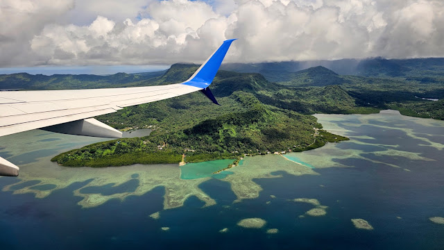
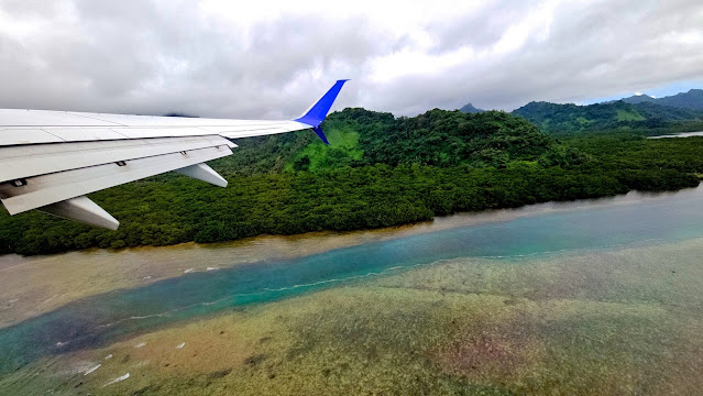
Welcome to The Marshall Islands (Marshalls for short), my 115th Visit and 110th Run UN Country.
The Marshall Islands (Pop 41,569) are a sprawling chain of 5 major volcanic islands, 29 coral atolls (24 populated) and 1,156 islets in the central Pacific Ocean, halfway between Hawaii and the Philippines in the middle of the Pacific Ocean. Marshalls cover a grand total island area of 180 square kilometres which is only 0.26% the size of Tazzie or the size of Metropolitan Sydney but this is spread out over 1.9 million square kilometres of ocean – almost 25% the size of Australia !!! Marshalls has 870 reef systems comprising 161 coral species and 798 fish species. In the northwest lies Bikini Atoll, which is used as a ship graveyard after World War II, and now a popular wreck dive site. Majuro Atoll, where I stayed, holds the Marshalls capital and largest settlement and is famous for the coral reef at Kalalin Pass, which teems with marine life. Majuro Atoll definitely reminds me of Tuvalu being a thin oval strip of land no wider than 1km and a total of 49km from end-to-end making it bigger than Tuvalu. Like Tuvalu the highest point on Majuro is only 3m above sea level !!!
Micronesian settlers reached the Marshall Islands using canoes circa 2nd millennium BC, with interisland navigation made possible using traditional stick charts. They eventually settled there and developed their own language called Marshallese, which is now spoken by two thirds of the population. As is the case of the islands I visited, Ferdinand Magellan, was the first European to land here in the 1520s and the Spanish soon followed a year or two later. Even the English visited here. The islands derive their name from John Marshall, who visited in 1788. The islands were historically known by the inhabitants as "jolet jen Anij" (Gifts from God). Spain claimed the islands in 1592, and the European powers recognized its sovereignty over the islands in 1874. Later, Spain sold some of the islands to the German Empire in 1885. In World War I, the Empire of Japan occupied the Marshall Islands. During World War II, the United States took control of the islands in the Gilbert and Marshall Islands campaign in 1944. Nuclear testing began on Bikini Atoll in 1946 and concluded in 1958. Apparently there is still some radiation recorded there in certain areas. The U.S. government granted independence to the Marshall Islands in 1979 and they joined the United Nations in 1991. Politically, the Marshall Islands is a parliamentary republic with an executive presidency in free association with the United States, with the U.S. providing defense, subsidies, and access to U.S.-based agencies such as the Federal Communications Commission and the United States Postal Service. With few natural resources, the islands' wealth is based on fishing, agriculture and limited tourism given its isolation. Marshalls use the US Dollar.
The majority of the citizens of the Marshalls are of Marshallese descent, though there are small numbers of immigrants from the United States, China, Philippines, and other Pacific islands. The dominant religion is Christian at 97.5% with 87% being Protestant.
My United UA155 flight from Pohnpei to Majuro was very educational as it tool in two stops. The first was the island of Kosrae still in Micronesia and the second was the island of Kwajalein in the Marshalls. Kosrae is not that large and not that populated only 45min flying time from Pohnpei. Kwajalein however is very interesting. It is 60min flying from Kosrae and tiny and entirely a US Military Base. You cannot stay here unless you have permission from the US Defence Department. The radar gear on this island is like a high-tech supermarket of every communications and satellite hardware ever invented !!! Apparently this island is the main eyes and ears on China and the gateway to the nuclear testing sites in the north and guards all the US WWII Navy Vessels that form part of the Pacific Graveyard north of this island !!!
Majuro Atoll itself is another 45min flying from Kwajalein and a tad under 10 square kilometres in area but its lagoon is big at 295 square kilometres. Suffice to say there is not a lot to see in Majuro – the main attraction is the lagoon islands and the coral along the islets of the north. I hired a taxi and in one day visited the following along the 49km length of the atoll: Laura (Longest Lagoon Beach & Church), Ajeltake (Oil Refinery, Mormon Church), Majuro Japanese Peace Park, Airport Park, Iakwe Katooj Park (Lake), Bahai House of Worship, Beaches (Two), Rairok/Rairikku (Baptist Church, US Embassy, Japanese Embassy, Shops, Beach), Longest Ocean Beach & Park, Japan-Marshall's Bridge, Biggest K&K Supermarket & Complex ATMs, Delap-Uliga-Djarrit Capital (Capital Building & Nitijela, International Conference Centre, Cathedral of the Assumption, Alele National Museum, Baet-U-Ahad Mosque).
My favourite place was Lijelbubub Beach right at the Western-most end of the atoll in a village called Laura. Google calls it Laura Beach but it is not – locals told me that Lijelbubub was a rat who was changed into a beautiful princess by the local sorcerer !!! It is one main spot where the ocean and lagoon connect and the water is to die for – crystal and 30C !!!
It quickly became apparent to me as my driver Ridhen took me along the island that the centre of town is struggling. Many closed businesses, unkept buildings and stray dogs. Tuvalu or Kiribati is nowhere near this. Further out people live in well-kept fibro houses under many palms and with mowed green lawns – heaps better condition and nice to look at. There are speed humps every few hundred metres to keep traffic speed under control given most kids walk to school. The other thing I noticed was a myriad of small graveyards with probably 10-50 graves each spread out all over the island – I am told the smaller ones are family plots that are situated on their own land that gets handed down from generation to generation. The larger ones a community graveyards for locals living in the area that do not own land or do not wish their loved ones to be buried on their own land since it is hard to sell land with graves already on the land – it is bad luck. The other reason for smaller graveyards spread out everywhere is that the atoll is not wide enough for one big cemetery and which also can get flooded in heavy storms.
The unquestionable highlight of my drive with Ridhen was the Dag Dance which you will have to wait for the film to see – it is very very special !!!
My second full day on Majuro was dedicated to visiting the island of Eneko 12km from my hotel by speedboat. The owner of my hotel also owns this island and has built a very small and exclusive bungalows on the island mainly for honeymooners from the US and Japan !!! The hotel is happy to run a shuttle out to the island for its mainland guests and I was the only one to go today and was on the island alone from 1030 to 1500 !!! The ride out there was identical to my experience in Tuvalu – lots of small islands or islets dotting the lagoon amongst green blue waters teaming with coral. Brilliant. Not just because of the island scenery and coral but because of what lay beneath these crystalline waters beside the coral – yes – a shot-down sunken US Aircraft – a DC3 belonging to Sea Star Pacific shot down in WWII – just 10ft down and very snorkable !!! Finally I found the wreckage of plane that I could free dive too and film. I looked for one in Guam and Saipan but had to come all the way out to Majuro to find one – I was so happy !!! Not only did I see an aircraft but a HELIPCOPTER as well !!! It was jackpot day and I was like a little kid in the Candy Store. Loved it.
After the launch left me, given I was the only human on the island of Eneko, I stripped naked and swam my first 2km nude swim amongst the zig-zagging coral off the island alongside myriads of naked fish. This is the most free and isolated I have ever felt – it is a mystical experience !!! After the swim, I walked to the end of the island and released my trusty drone Mini into the deep blue skies above to bring you what will be the most heavenly jaw-dropping atoll scenery you will ever see…
Food in the Marshalls is typical Pacific Islander - true locals eat fish and breadfruit (like potato) but the rest is spoiled by American influences. I enjoyed plenty of tuna mixed with veggies. Sadly garbage is a HUGE issue here just like in Tuvalu and stacked up near the middle of the island next to the airport where noone wants to live. There is a Chinese company that collects anything aluminium especially Bud Beer cans !!! The government recently banned plastic shopping bags in favour of paper bags but the plastic from years gone by has nowhere to go...
Someone found out that I was here and sent a US jet to collect me - see it below !!!
Majuro Atoll of the Marshall Islands promises to be the visual highlight of the Pacific in this amazing journey amongst the Caroline Islands of the Western Pacific. If the photos don't get you then the film will – enjoy…


.jpg)


.jpg)


.jpg)


1 comment:
Love it John!
Post a Comment